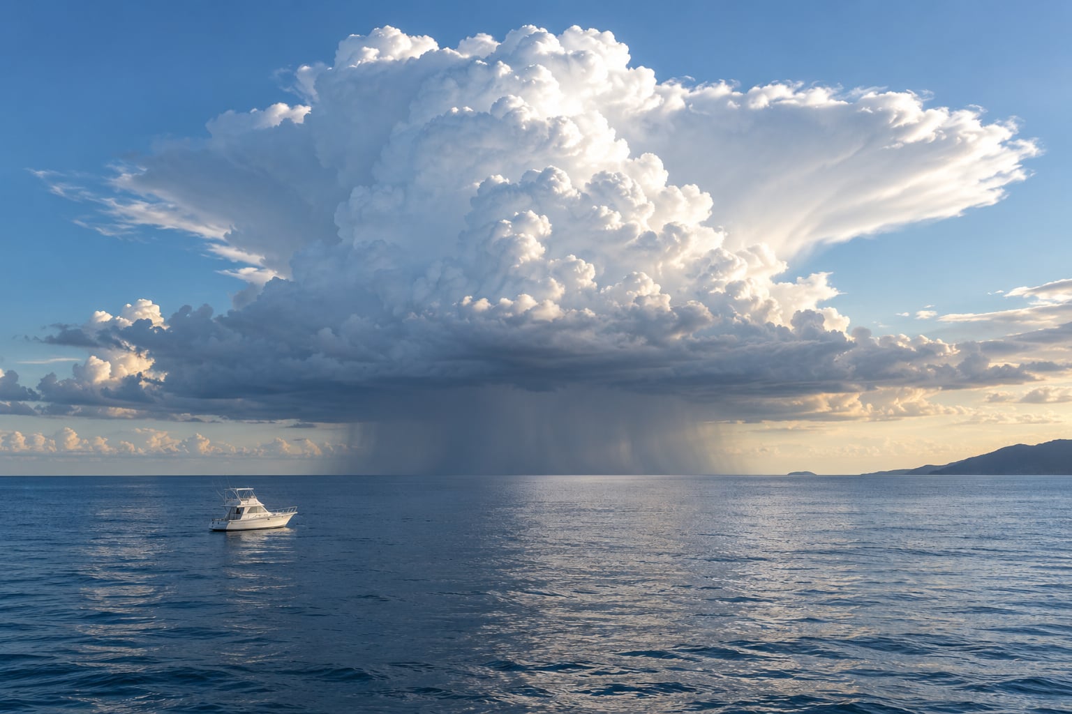
Offshore thunderstorms give you more warning than almost any other weather hazard on the water. The first sign is usually a towering cumulus building vertically against the horizon, then a darkening base, an abrupt wind shift, and a barometer that starts to fall. Learn to spot a thunderstorm building offshore by watching clouds, wind, water and radar together, and you usually get 30 to 60 minutes to get somewhere safe.
That lead time is the whole game. A thunderstorm that surprises you at 5 miles gives you no options. The same cell spotted at 20 miles means you can reef early, get the engine running, call it in on the radio and point for the nearest inlet.
Reading a sky takes practice, though, and most people learn it the hard way. Here is the process I use, in the order it matters.
Table of Contents
- What You Need
- Step-by-Step: How to Spot a Thunderstorm Building Offshore
- 1. Scan the horizon for towering clouds
- 2. Notice clouds that grow darker and taller
- 3. Watch the wind and water for a sudden shift
- 4. Check for lightning and distant illumination
- 5. Compare radar and satellite clues
- 6. Estimate whether the storm will reach you
- 7. Leave exposed water before conditions deteriorate
- 8. Know the storm types you are looking at
- Common Mistakes
- Frequently Asked Questions
- What is the first indicator of a thunderstorm at sea?
- What is the 30-30 rule for lightning?
- How far away is a storm if I count five seconds between lightning and thunder?
- How do I read weather radar offshore when cell coverage is poor?
- Can you outrun a thunderstorm in a boat?
- What should I do first if a thunderstorm catches me offshore?
What You Need
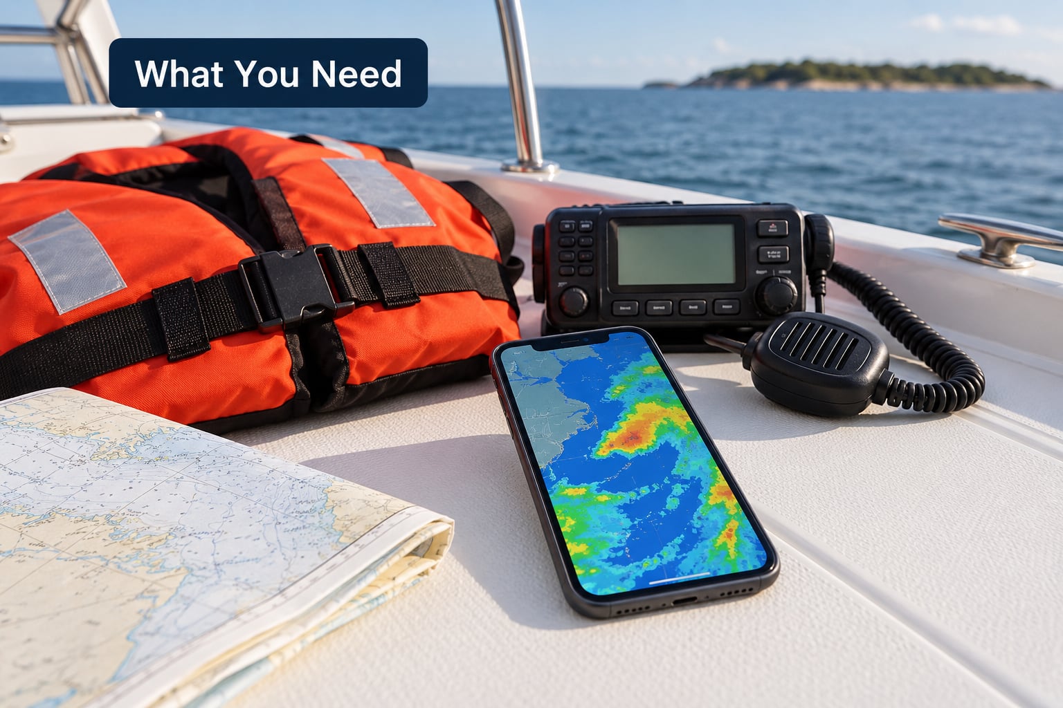
You cannot spot a storm with your eyes alone if you have no way to leave. Before you clear the dock, have these aboard and actually working.
A charged phone in a waterproof case. Phone radar apps give you the widest view for the least fuss, and a dead phone at 20 miles from a cell is a real problem.
A marine VHF radio. Coastal stations broadcast continuous weather updates on the emergency weather frequencies, and a handheld unit works fine in a cockpit.
A working barometer, either analog or in a combined depth, speed and log unit. A steady fall of a few millibars an hour matters more than any single reading.
A properly fitted life jacket for everyone aboard. Squalls put people in the water without warning, and cold shock makes a swim fatal in minutes.
A planned exit. Pick two possible places to duck in before you leave the harbour, and check the tide. A cove that protects you at high water can be a death trap three hours later.
Step-by-Step: How to Spot a Thunderstorm Building Offshore
1. Scan the horizon for towering clouds
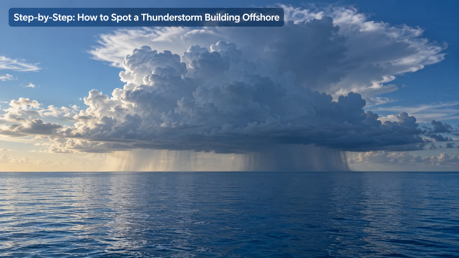
Look along the horizon rather than overhead, because that is where a developing cell shows itself first. Fair-weather cumulus have flat bottoms and modest height, and they shrink or drift apart over an hour or so.
A storm-building cumulus grows upward instead. Watch a single tower for two or three minutes and it should visibly change shape, throwing new cauliflower turrets up on one flank while the old ones boil and darken. That vertical development is the first indicator, and it is the one most often missed by people staring straight ahead.
An anvil top spreading flat and wide at the highest point means the updraft has hit the tropopause and stopped climbing. Once you see that, the storm is no longer a possibility. It exists.
2. Notice clouds that grow darker and taller
Colour is the second signal. Sunlit cumulus is bright white with crisp edges. As a cloud thickens, the base goes grey, then a hard dark grey that sits noticeably lower than the white tower above it. That flat, dark base is where condensed water is heavy enough to fall out as rain.
Prefer a fixed reference point. Pick a buoy, a headland or the top of a mast and note the angle to the cloud base every fifteen minutes. A tower that grows from a sliver above the horizon to half your mast height in half an hour is developing fast enough to matter.
3. Watch the wind and water for a sudden shift
Clouds tell you a storm exists. Wind and water tell you where it is. The leading edge of a storm carries cold air spreading out at the surface, and the shift often arrives long before the rain does.
Look for a gust front: a darker band on the water, a line of ruffled surface, or a sudden swing of 30 to 90 degrees in the wind over a couple of minutes. Check for a sharp temperature drop, a falling barometer, and the smell of ozone or wet dust that sometimes arrives before the storm itself.
Under the cell itself, the sea goes from smooth to choppy in seconds and visibility can collapse to almost nothing. Offshore, a flat calm morning is often the setup rather than the comfort. Warm, still air over the water with nothing to interrupt it is exactly the fuel a thunderstorm needs.
4. Check for lightning and distant illumination
Lightning is proof, not a warning. The moment you see a flash, a storm capable of producing it is already close enough to hurt you.
You can estimate the distance by counting the gap between the flash and the sound. Sound travels roughly 1,100 feet per second, so divide the seconds by five to get miles. A five-second gap puts the strike at about one mile. For the wider view, most radar apps now layer lightning strike data, which tells you whether those flashes are walking your way or moving off to one side.
At night you lose the cloud structure but gain the flashes. A strobing patch of light low on the horizon with no visible cloud is a cell just beyond your visual range, and it is still working.
5. Compare radar and satellite clues
Radar answers where the cells are right now; your eyes tell you whether they are growing. Use both, and know the limits.
The radar beam curves with distance, so a cell 60 miles out shows you its upper levels while missing the storm at your level. Coastal radar also fills with clutter from sea clutter and biological returns. Offshore cells, which have nothing to reflect off them, often read weaker than they are. Confirm a weak return with a visual tower before you relax.
On the radar loop, watch the last two hours rather than the current frame. Cells often track along a line toward the coast, and a cluster that looks harmless can merge with the next one.
6. Estimate whether the storm will reach you
Ask three questions. Where is the cell relative to me? Which way is it moving? What is between us? A distant anvil with a steady outflow boundary can still be tracking right at your boat, and a healthy cumulus with no motion can sit on you for an hour.
Watch for the outflow boundary itself, the sharp line between smooth and rough water under a cloud. It separates the storm outflow from the surrounding air and it often moves faster than the cell that made it, sometimes 20 to 30 knots across the surface. If that boundary is heading your way, you do not need to be under the storm to have a problem.
One more cue matters offshore: virga. Streaks of rain falling from a cloud base but evaporating before they reach the sea are the driest sign of a downdraft, and they are often the tail end of the outflow. Jellyfish-shaped tendrils hanging beneath a base mean the downdraft has mixed with moist air. Both tell you the storm is spending its energy on wind rather than rain.
7. Leave exposed water before conditions deteriorate
The decision to move is worth more than any observation. Once you have a growing tower and a falling barometer, start leaving.
Reef or furl early rather than at the last moment. Start the engine before the wind is on the beam, because a stalled boat in a shift is a boat with no steerage. Get the crew inside and off the metal rigging, the mast base, the tiller and any exposed hydraulic line. A carbon mast is a poor conductor but it burns, and a nearby strike sends an induced surge along the wire.
Head for shelter rather than trying to outrun it. Cells move in a direction, and so do you, but a storm does not have to be directly overhead to hurt you. Close the range early and let it pass behind you.
8. Know the storm types you are looking at
Different storms look different and need different responses. Air mass storms are the Florida and Gulf afternoon type, isolated and slow, usually with a generous window to get clear. Frontal storms ride a boundary and arrive with a sharp line rather than a build-up.
Squall lines are a row of cells moving together, so the gap between them shrinks fast. Microbursts are the dangerous surprise: a column of air dumped in seconds and spread outward, capable of abrupt wind shifts and speeds that no part of a normal forecast describes.
Common Mistakes
Assuming a distant storm is a show rather than a threat. Offshore cells move toward you constantly, and you are often the tallest thing around. Treat distance as something to close, not admire.
Relying on the phone alone. Cellular coverage is fine in the bay and gone 20 miles out. Carry a VHF and know the local broadcast schedule.
Treating a clear horizon as safety. A gap in the clouds is not an absence of weather. Look higher, and remember the tallest cell can be 30 miles beyond the visible horizon.
Waiting for thunder. By the time you hear it, you are inside the storm’s life cycle. Sound carries roughly a mile, and the visual cues come much earlier.
Misreading radar at distance. The beam misses low-level storm at range. Treat weak distant returns as real until the sky disagrees.
Continuing toward an exposed coastline. A headland that shelters you from north wind funnels it from the south. Know the shoreline before you need it.
One more rule that covers most of the rest: reducing sail early is almost never wrong. Boats get damaged by carrying too much canvas in a shift they did not see coming.
Frequently Asked Questions
What is the first indicator of a thunderstorm at sea?
The first indicator is a cumulus cloud growing vertically over a short time, throwing new turrets upward while the base darkens and flattens. Watch a fixed reference point such as a buoy or a masthead and you should see it change in minutes. Supporting signs are a falling barometer, an abrupt wind shift, a sharp temperature drop, and the smell of ozone. If the tower starts to spread into a flat anvil, the storm is already established.
What is the 30-30 rule for lightning?
The 30-30 rule has two halves. First, count the seconds between seeing a flash and hearing thunder. If thunder arrives within 30 seconds, the strike is close enough to be dangerous and everyone should get below and away from metal. Second, wait 30 minutes after the last thunder before resuming the activity. On a boat the shelter half is often unavailable, so the practical version is simply: close the distance early and stop touching the mast, rigging or tiller.
How far away is a storm if I count five seconds between lightning and thunder?
About one mile. Sound travels roughly 1,100 feet per second, so divide the number of seconds by five to get the distance in miles. That gives a three-second gap at just over half a mile and a twenty-second gap at four miles. Lightning does not travel in a straight line from the cloud, so treat this as a minimum estimate and keep doubling the safety margin offshore.
How do I read weather radar offshore when cell coverage is poor?
Use radar for direction and trend rather than precise distances. The beam curves with range and shows upper storm levels while missing what is happening at your level, and coastal radar picks up clutter. Overlap the loop with your own horizon scan, watch the last two hours of movement, and confirm weak returns with a visible tower before you relax. Keep a VHF receiver running as a backup source.
Can you outrun a thunderstorm in a boat?
Sometimes, but do not plan on it. Many boats make more speed than a slow-moving afternoon cell, and a faster powerboat can usually pull away. The mistake is assuming that every cell moves at the same speed and in a straight line, when cells merge, stall, back up and shift direction. Running also moves you away from the shelter you already identified. Closing range toward protection is the safer bet.
What should I do first if a thunderstorm catches me offshore?
Reduce sail and get the engine running first, while you still have steerage. Then get the crew below and off anything metal, including the mast base, rigging, tiller and hydraulic steering. Call the storm position and intentions on VHF if you have time, and keep a note of your position. Wait for the cell to pass rather than trying to power through the core, and check your crew for cold and shock symptoms afterward.
If you take one thing from this, make it the horizon. Pick a reference point on the water, glance at it every fifteen minutes, and learn what a growing tower looks like from your own boat. That habit alone is usually enough to know how to spot a thunderstorm building offshore before it arrives, and it costs nothing but attention.