What causes a king tide? It happens when the Sun, Moon and Earth line up at new or full moon while the Moon is also at its closest approach to Earth, called perigee. That combination produces a perigean spring tide, the technical term for what people usually call a king tide, and the extra water has nowhere to go but onto low ground.
The word itself is worth flagging early. NOAA and most coastal agencies do not treat “king tide” as an official hazard category; it is a media and public nickname. What matters on a tide chart is the predicted height, the local flood threshold, and what the weather is doing on top of it. This guide walks through the physics, the variations from one coastline to the next, and the practical planning side that boaters, paddlers, anglers and trail users care about.
Forecasts and tide data change every year, so check your local station before you plan around a specific date rather than trusting a date you read somewhere else.
Table of Contents
- How Does a King Tide Form?
- King Tide Astronomy and Water Levels at a Glance
- Why Do King Tides Vary From Place to Place?
- How Does Weather Change the Impact?
- What Causes a King Tide and What It Means in Practice
- How Can You Tell Whether a King Tide Will Cause Flooding?
- How to Prepare for a King Tide
- Common King Tide Myths and Misconceptions
- Frequently Asked Questions
- Is a king tide the same as a tsunami?
- Are king tides predictable if tides are predictable?
- Does a king tide always cause flooding?
- Can king tides happen without a storm?
- How does sea-level rise affect king tides?
- Are king tides more dangerous for boaters and paddlers?
- What to Do Before the Next King Tide
How Does a King Tide Form?
A king tide forms when three things stack on the same day. Take them one at a time, because each one is a small effect that only becomes a problem in combination.
1. The spring tide alignment. The Moon’s gravity pulls seawater into a tidal bulge, and the Sun pulls a smaller one. When the Sun, Moon and Earth sit in a straight line at new moon or full moon, both pulls act on the same axis and the bulges combine. High tides run higher and low tides run lower than usual. This happens roughly every 14 days and has nothing to do with the season, despite the name. The word comes from the old sense of a tide “springing forth.”
2. Perigee. The Moon’s orbit is elliptical, so its distance from Earth swings between roughly 356,000 and 407,000 kilometers. At the near end, perigee, its gravitational pull is at its strongest. A spring tide that lands within a day or two of perigee is a perigean spring tide.
3. The amplifiers. A perigean spring tide sets a high baseline. Everything else in the water column then adds to it: a higher mean sea level from long-term rise, a seasonal shift, wind pushing water toward shore, and low pressure sagging the sea surface itself. NOAA and university researchers who study these events routinely separate the astronomical tide from the weather-driven part for exactly that reason.
Perigean spring tides happen roughly three to four times a year, when perigee coincides closely with a new or full moon. But not every perigee lines up perfectly, and how high the water gets depends on where you are standing. A tide that is unremarkable at one gauge can put water over the road at another, ten miles away.
King Tide Astronomy and Water Levels at a Glance
Most confusion comes from treating five different things as one. Here is how they differ.
| Event | What causes it | Timing | What it means in practice |
|---|---|---|---|
| Astronomical tide | Gravity of the Moon and Sun on the ocean | Every day, twice each | The predictable baseline your tide table describes; it happens regardless of weather |
| Spring tide | Sun, Moon and Earth aligned at new or full moon | About every 14 days | Widest tidal range: higher highs and lower lows; more exposed flats and stronger currents |
| King tide | Spring tide plus the Moon near perigee, plus sea level rise and weather | Three to four times a year | The high baseline gets close to or above the local flood threshold, sometimes under clear skies |
| Storm surge | Wind and low pressure from a coastal storm | Hours to days during a storm | Unpredictable water added on top of whatever the tide is doing; the dangerous combination |
| Coastal flood | Any water level that reaches a local threshold | Varies | Water on a road, dock or ramp; the threshold is set locally, not nationally |
Two numbers matter when you read a chart. The predicted tide is the astronomical part alone. The observed water level includes wind, pressure and swell, and the difference between the two tells you how much the weather is adding.
Everything is measured against a datum. Mean higher high water, usually written MHHW, is the average of the highest high tides recorded at a station over a full lunar cycle. A forecast above MHHW is high enough to reach the high tide line most days, and those are the tides that flood low spots.
Why Do King Tides Vary From Place to Place?
The same astronomy produces different water levels everywhere. The reason is shape: the depth and shape of the coastline decide where that extra water piles up.
Bathymetry and shelf shape. Water that funnels into a shallow, gently sloping shelf has nowhere to spread out, so the same tide arrives higher. Steep drop-offs let excess water drain away instead of stacking.
Resonant inlets and sounds. Some bays and tidal inlets have a natural sloshing period close to the incoming tide, which amplifies the high water. Others cancel it out. That is why an inlet can flood while open beach two kilometres away stays dry.
Tidal range. Range matters more than height. A coast with a small tidal range sits permanently near its flood threshold, so a foot of extra water closes a road. A macrotidal coast may take three or four times that and never spill.
Sea level rise. This is the quiet amplifier. Every centimeter of rise moves the whole tidal curve up, so the same king tide reaches farther inland than it did a generation ago. That is why a tide that flooded once a decade now floods several times a year at the same station. Low-lying sections of the Atlantic and Gulf coasts are where this shows up first, though it applies anywhere.
Subsidence and local land movement. Ground that is settling, whether from groundwater withdrawal or geological adjustment, lowers the land relative to the water. A couple of centimeters of local sinking can matter as much as a decade of global rise.
Wind and seasonal sea level. Persistent onshore wind drags surface water toward the coast and holds it there for days. Seasonal effects, including El Niño, shift the baseline up or down and can nudge whole seasons toward higher highs.
How Does Weather Change the Impact?
Onshore wind is the biggest one. Wind blowing onshore pushes surface water toward shore, and the effect builds over hours, so a day or two of steady onshore wind can add a substantial amount to the high tide. Offshore wind does the opposite and pulls water away, which is why some places stay open during the same event that floods a neighboring town.
Low pressure physically lifts the sea surface. A drop of one millibar in air pressure is roughly a centimeter of water, so a deep low sitting over a coast raises the baseline on top of the surge. Heavy rain matters less directly, though saturated ground cannot absorb water and storm drains can back up when the tide is already high inside them.
Storm surge is the dangerous part because it is the least predictable. Astronomical tides can be forecast years ahead to the minute. A hurricane’s surge cannot. When a deep low, onshore wind and a king tide arrive together, that is the combination responsible for most major coastal flood events.
What Causes a King Tide and What It Means in Practice
Knowing the physics only helps if you know what changes on the ground. The consequences are remarkably consistent from place to place.
- Low roads and access routes go under. A low spot that stays dry all year can be impassable for two or three high tides. Marsh causeways, campground roads, trailheads behind dunes and low bridges are the usual casualties.
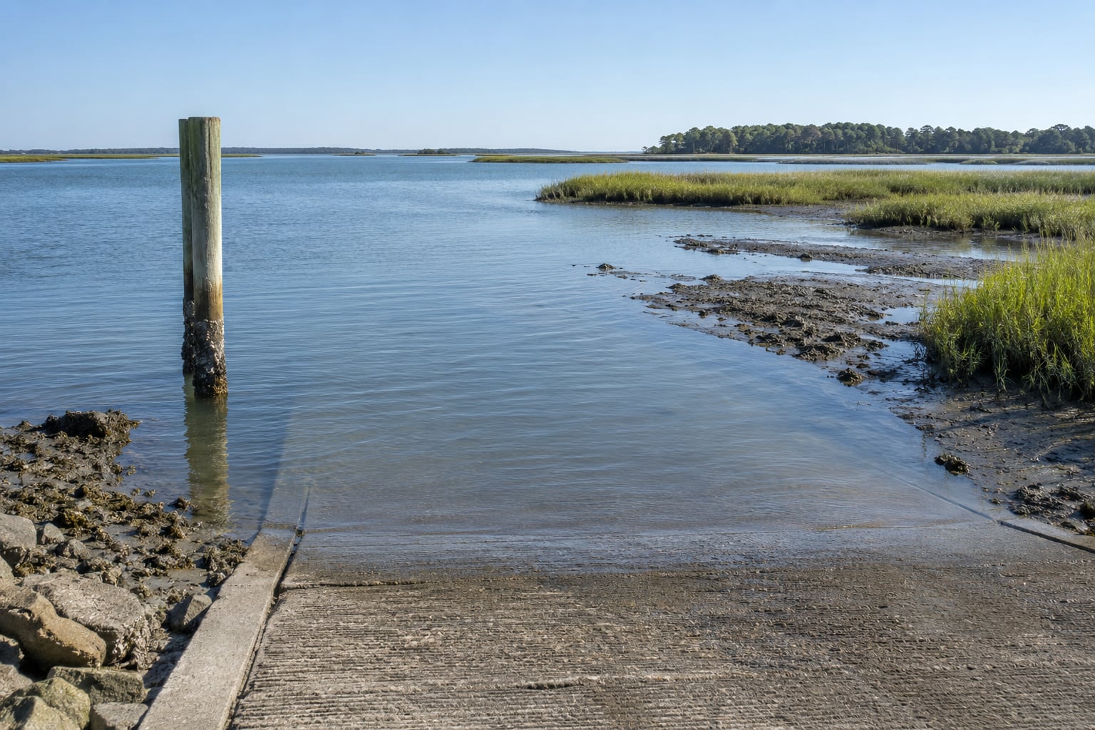
- Boat ramps flood and launching gets harder. A ramp with a fixed surface can be covered at the top of a king tide, and trailers sit deeper in the water than the winch line allows. Currents at the ramp mouth often run hardest right around the turn.
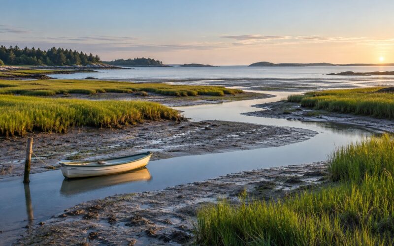
- Marsh channels get more dangerous, not less. A spring tide pushes more water through a tidal narrow over a longer window. Paddlers who know an ordinary ebb channel can be caught out by a flood-ebb cycle running far harder than expected, with no slack water at the turn.
- Float docks and mooring lines take the load. Flooding lifts docks off their piles. Mooring lines that were snug go slack at high water and can chafe or snap as the water drops.
- Erosion and wrack lines. Higher high tides reach the toe of dunes and the base of marsh banks. Wave action working at that higher level strips the bank faster than recovery can keep up. The line of dried eelgrass, wrack and shell debris left behind is a useful marker of where the high water reached.
- Saltwater intrusion. Flooded yards and wells pick up salt, which kills turf, damages vehicles and corrodes anything electrical. Repeated minor flooding is usually harder on property than one larger event.
- Drainage backs up. Storm drains and outfall gates that discharge through the tide cannot drain when sea level is higher than the pipe. Water that would have left the system sits in streets instead.
- Birds and feeding habitat shift. Extreme low water on a spring tide exposes mudflats far beyond their normal extent. That is productive feeding for shorebirds and waders, which is worth planning around, but exposed flats in strong sun mean less food and more heat stress than usual.
For anglers, the practical effect is that fish holding depth changes. Water pushed out of a marsh or bay concentrates bait and fish in the remaining channels and edges. Saltwater moving up a creek or overtopping a dike raises the salinity in the upper reaches, which pushes sensitive species down-estuary for a day or two.
How Can You Tell Whether a King Tide Will Cause Flooding?
A tide table alone cannot tell you. It is a good starting point, but you need to compare it against local thresholds.
- Find the official forecast for your station. NOAA’s tide and current portal publishes predicted high tides and times for the whole US coastline and Great Lakes. Most state and regional agencies link to their own local gauge network with updates measured rather than predicted.
- Compare the prediction with MHHW. A forecast above MHHW is a high tide that reaches the shoreline features most days. That is your first screen.
- Check the local flood threshold. Flood stage for a specific road or basin is set locally and is usually a specific height at a specific gauge. Programs and local emergency management offices show which roads close and when. The threshold, not the astronomical tide, is what decides whether water is on the pavement.
- Add the weather forecast on top. Onshore wind and a low-pressure system raise the expected water level. If both are in the forecast for the same window, assume the low road will close.
- Look at recent rainfall. Saturated ground and full storm drains turn a marginal tide into a closed road.
- Watch official alerts. Local authorities and the National Weather Service issue flood advisories when water levels are forecast to reach flood stage.
One useful rule of thumb comes from tidal-flood researchers: a water level exceeded only two or three times a year is a fair practical stand-in for MHHW at a given station. It is a screening test, not an official standard, but it works well enough to spot the days worth planning around.
Worth remembering: the astronomical tide is known months ahead. The observed water level is not. Two tides that look identical on a chart can produce entirely different results on the ground.
How to Prepare for a King Tide
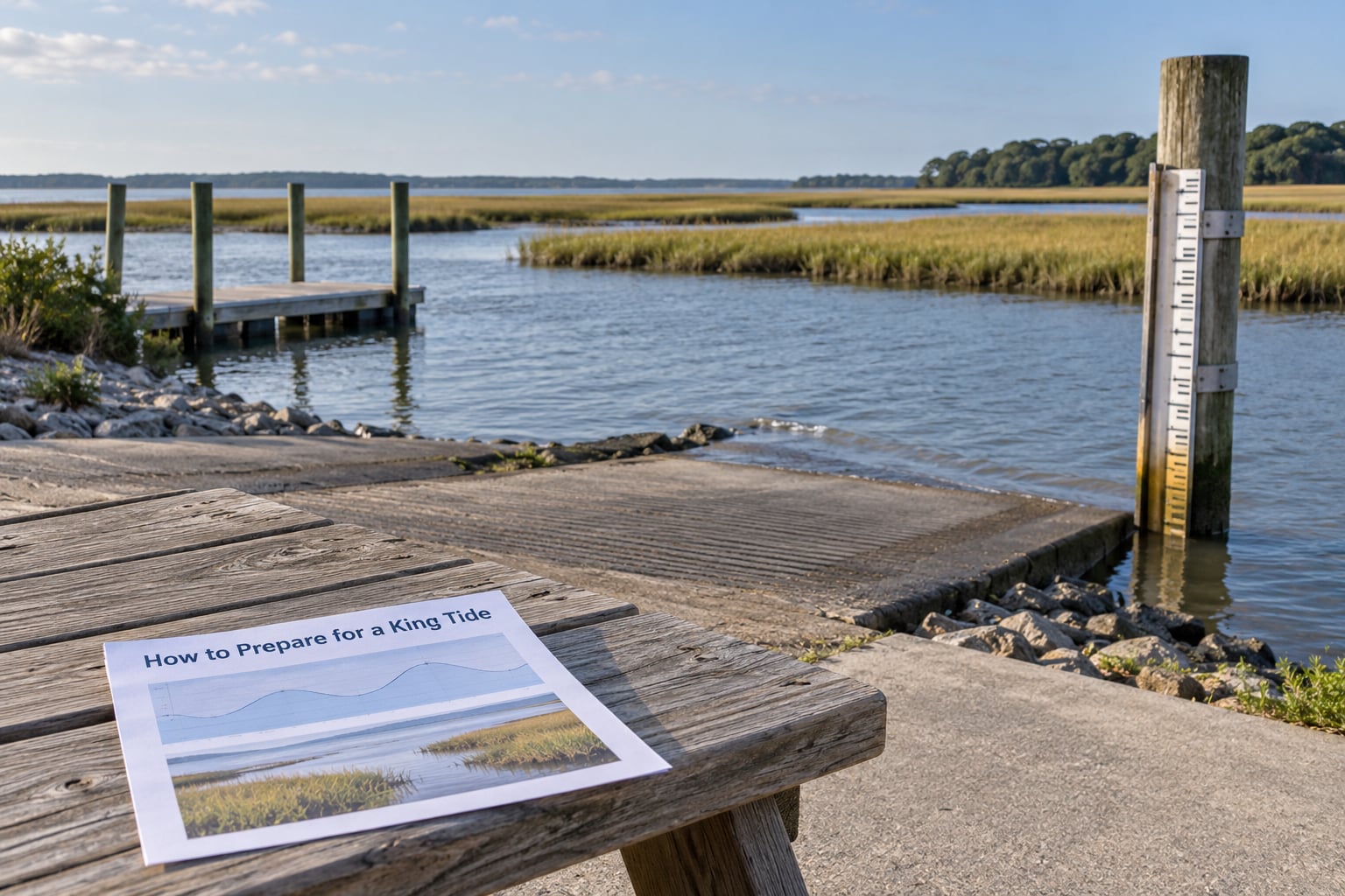
Preparation is mostly about timing. The tools are free and the information is public, so there is no excuse for guessing.
- Time your trip to slack water. For launching, paddling or crossing a tidal flat, plan around the turn of the tide rather than the middle of the flood or ebb. Slack is the calm window; the rest is current.
- Start well below the flood threshold. Aim to be off the water and off exposed flats before the rising tide reaches MHHW, not at it.
- Never drive through floodwater. A foot of moving salt water over a road can float a vehicle, and the road under it may already be scoured out. If water is over the roadway, turn around and take the inland route.
- Raise or secure anything at low elevation. Move gear, fuel and electrical equipment above the high water line. Put the trailer in overnight. Give floating docks extra line and leave it slack.
- Expect stronger current in narrows. A spring tide runs harder through channels for longer, with little slack water. Paddle with the flood when you need to get to a landing, and check the tidal current station for your inlet rather than guessing from the river mouth.
- Respect closures. If a road, ramp, trail or boat launch is closed for the tide, the closure is there because the water level is known to be dangerous. Local authorities close these for a reason.
- Plan wildlife access around the tide, not against it. For mudflat birding, go when the falling tide exposes the flats, and get off before the flood cuts the route back.
On the fish and shellfish side, repeated tidal flooding moves saltwater into places it does not normally reach. If you harvest after a flooding event, follow current state advisories on shellfish closures and fish consumption rather than relying on the tide chart.
Common King Tide Myths and Misconceptions
Myth: king tides are caused by climate change. They are not. The cause is gravitational and orbital, and it has operated since long before there were tide gauges. What climate change does is raise the sea level underneath those tides, so each one reaches further than it used to. The tide is the trigger; rising water is why it now reaches your street.
Myth: king tides are storms or hurricanes. They often happen under clear skies, which is why they are called sunny-day flooding or nuisance flooding. A hurricane can combine with a king tide, but the two are separate events with separate forecasts.
Myth: king tides bring big waves and heavy surf. Wave height and swell are controlled by wind and distant storms, not by lunar distance. King tide days can be glassy calm, and an ocean day can be flat with the tide running to the highest mark of the year.
Myth: every spring tide is a king tide. Spring tides happen about every 14 days. A king tide is the subset that coincides with perigee, plus whatever the sea level and weather are doing. Most spring tides go completely unnoticed.
Myth: a king tide is officially named. It is a public nickname. NOAA’s own guidance explains the astronomical tide as the predictable component and the observed water level as the real number. When a local agency issues a flood warning, it cites a gauge height, not a tide name.
Myth: flooding during a king tide is unpredictable. The high tides and their times are forecast precisely. What is not forecast precisely is wind and pressure on top of them, which is the difference between a damp road and a closed one.
Frequently Asked Questions
Is a king tide the same as a tsunami?
No. A tsunami is a fast-moving ocean wave set off by an undersea earthquake, volcanic eruption or landslide, and it can arrive in minutes. A king tide is the ordinary rise and fall of the tide, made higher by gravity and orbital alignment, and it floods slowly over hours. A tsunami carries enormous energy. Confusing the two gets people killed.
Are king tides predictable if tides are predictable?
The astronomy is very predictable. Tide tables predict high and low times and heights a year or more ahead, and lunar perigee dates are published well in advance. What is less predictable is the water above that prediction, because wind, pressure and swell decide how much extra water the same tide delivers. Plan the timing confidently; plan the height from a short-range forecast.
Does a king tide always cause flooding?
No. A king tide describes the tide, not the outcome. Many perigean spring tides each year stay well below flood stage and flood nothing at all. Flooding happens when the combined water level crosses the local threshold, and that threshold is set for one specific place. On a coast with a large tidal range, the year’s highest water can still stay well clear of the roads.
Can king tides happen without a storm?
Yes, and that is the usual case. A perigean spring tide on a sunny, windless day can reach MHHW or higher and flood low spots with no storm anywhere near the coast. That is why the terms nuisance flooding and sunny-day flooding exist. Coastal agencies handle these on a routine seasonal schedule because the flooding follows the lunar cycle, not the weather.
How does sea-level rise affect king tides?
Rising sea level lifts the whole tidal curve, so the same perigean spring tide arrives higher against the same coastline. A high tide that flooded once every five years can start flooding several times a year with no change in the astronomy at all. Low-lying roads, marsh and shoreline feel this first, and flood thresholds set decades ago may need resetting as the baseline climbs.
Are king tides more dangerous for boaters and paddlers?
Yes, in one specific way. A king tide adds height rather than speed, but the larger tidal range that comes with it means faster currents and almost no slack water in channels for hours. That removes the window paddlers rely on to turn, cross or land. Rising water also cancels out low bridges and marsh causeways, and flooded ramps make launching the hardest part of the trip.
What to Do Before the Next King Tide
Start with your official local tide source, whether that is NOAA’s tide portal or your state agency’s gauge page, and know your local flood threshold by heart. Compare the next predicted high tide against MHHW, then check the wind and pressure forecast for the same window.
Watch for access alerts on the roads, ramps and trails you actually use, and treat any closure as final. If the forecast puts a strong onshore wind on top of a perigean spring tide, postpone any trip that depends on exposed flats, low causeways or a fixed ramp, and move the boat or gear above the high water line before you leave.
That is the whole job: know the number, know the threshold, know the weather, and leave when they stack up against you.