If you want the short answer to how sea level rise affects coastal marshes, it is this: marshes flood more often, their edges erode, and salt water reaches places that used to be fresh. Whether a marsh keeps up depends on how fast its surface builds upward compared with how fast the water climbs. That single balance decides most of what happens next.
The good news is that marshes are not passive sponges that simply wash away. They are living systems that trap sediment, build their own soil and, in the right conditions, move inland as the shoreline retreats. The trouble is that most of our remaining marsh is hemmed in by roads, houses and seawalls, so the escape route is often closed.
This guide explains the process in plain language, then looks at what you can actually see on a marsh you visit, what conservation options exist, and where each one breaks down. Figures come from NOAA, USGS and published marsh research; local numbers vary a great deal from one estuary to the next.
Table of Contents
- What Does Sea Level Rise Do to Coastal Marshes?
- What Does Sea Level Rise Actually Mean, and Why Does “Relative” Matter?
- How Sea Level Rise Affects Coastal Marshes Over Time
- Flooding, Erosion, and Habitat Shifts
- What Happens to Salt Marshes and Freshwater Marshes?
- Why Can Rising Seas Increase Carbon Emissions?
- How People and Development Intensify the Effects
- What Conservation Strategies Can Help Coastal Marshes?
- What Can Outdoor Visitors Learn From Changing Marshes?
- Frequently Asked Questions
- Will all coastal marshes disappear as sea level rises?
- Why can a coastal marsh not simply move inland?
- Do seawalls protect marshes from sea level rise?
- How long does it take for sea level rise to change a marsh?
- What can I do to support coastal marsh conservation?
- Conclusion
What Does Sea Level Rise Do to Coastal Marshes?
Sea level rise floods a coastal marsh more often, stresses its plants, erodes its edges and eventually converts it to open water if the marsh surface cannot build upward fast enough. Marshes survive by accreting sediment and organic matter. When rising water outpaces that growth, the marsh drowns or is squeezed out.
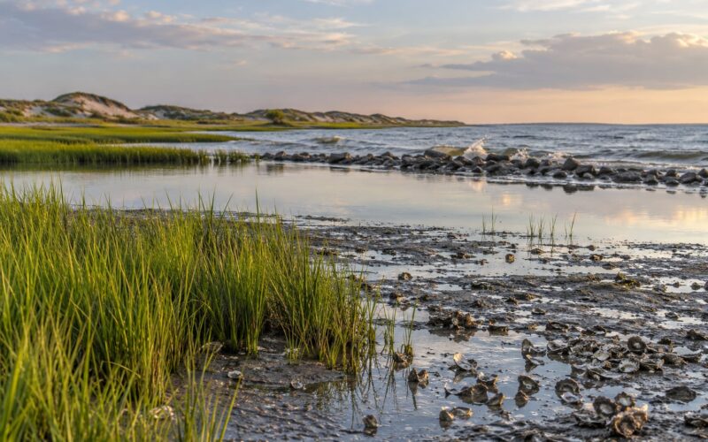
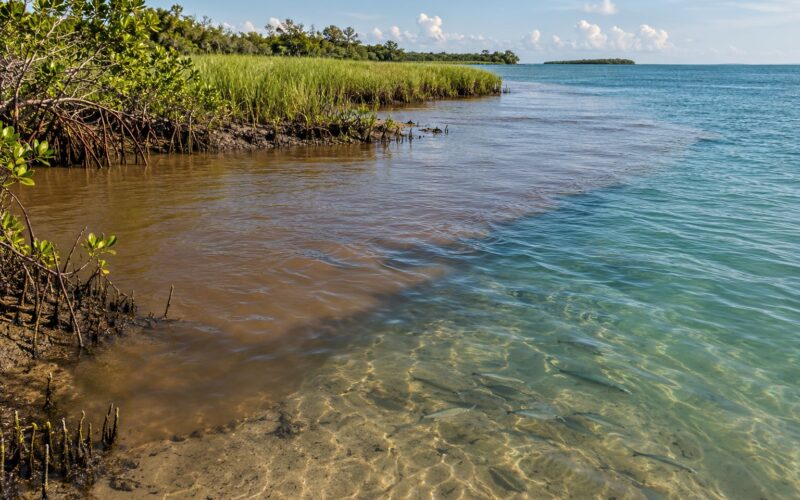
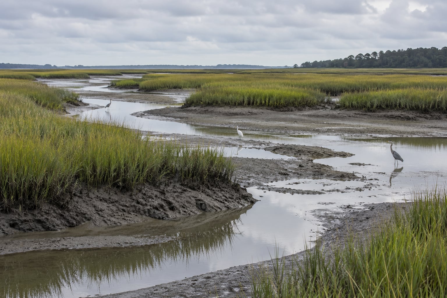
A coastal marsh is a flat, low-lying wetland that sits between roughly mean sea level and mean higher high water. Daily tides wash over it, delivering fine silt and organic debris that settle out and raise the marsh platform. Cordgrass, black rush, mangrove roots and a dense mat of underground roots hold that material in place.
Gradual sea level rise on its own is something a healthy marsh can handle for a long time. What shortens that timeline is everything layered on top of it: storm surge that strips the surface, subsidence that drops the land while the ocean climbs, sediment starvation from levees and dredging, and development that blocks the marsh from moving inland.
Those four pressures are usually what turn a slow process into a lost one.
- Elevational drowning: water depth and duration pass what the vegetation can tolerate.
- Edge erosion: waves and storms cut into the marsh from the open-water side.
- Saltwater intrusion: salinity moves up creeks and into freshwater wetlands.
- Coastal squeeze: the marsh cannot migrate inland because something blocks it.
What Does Sea Level Rise Actually Mean, and Why Does “Relative” Matter?
Relative sea level rise is the number that matters locally. It combines the ocean rising with the land sinking or rising underneath it. The global mean rate is currently around 3.4 to 4.3 millimeters per year and climbing, but a place on subsiding delta sediment can see water rise several times faster than the global average.
Parts of the northern Gulf Coast and the Chesapeake Bay region sit on sediment that is compacting under its own weight. Add groundwater pumping and it gets worse. Around the Bay Area, local relative sea level has historically run near 8 inches per century, which is well above the global figure.
Two datums explain most marsh science. Mean sea level is the halfway point of the tidal cycle. Mean higher high water marks the average of the highest high tides, and it is the level a marsh needs to reach before it gains elevation.
So when someone says a marsh will be “underwater” by a date, read it carefully. It usually means regular tidal flooding will reach a given elevation more often, not that the ground suddenly vanishes. Chronic inundation kills vegetation first, then the marsh becomes mudflat and then open water.
How Sea Level Rise Affects Coastal Marshes Over Time
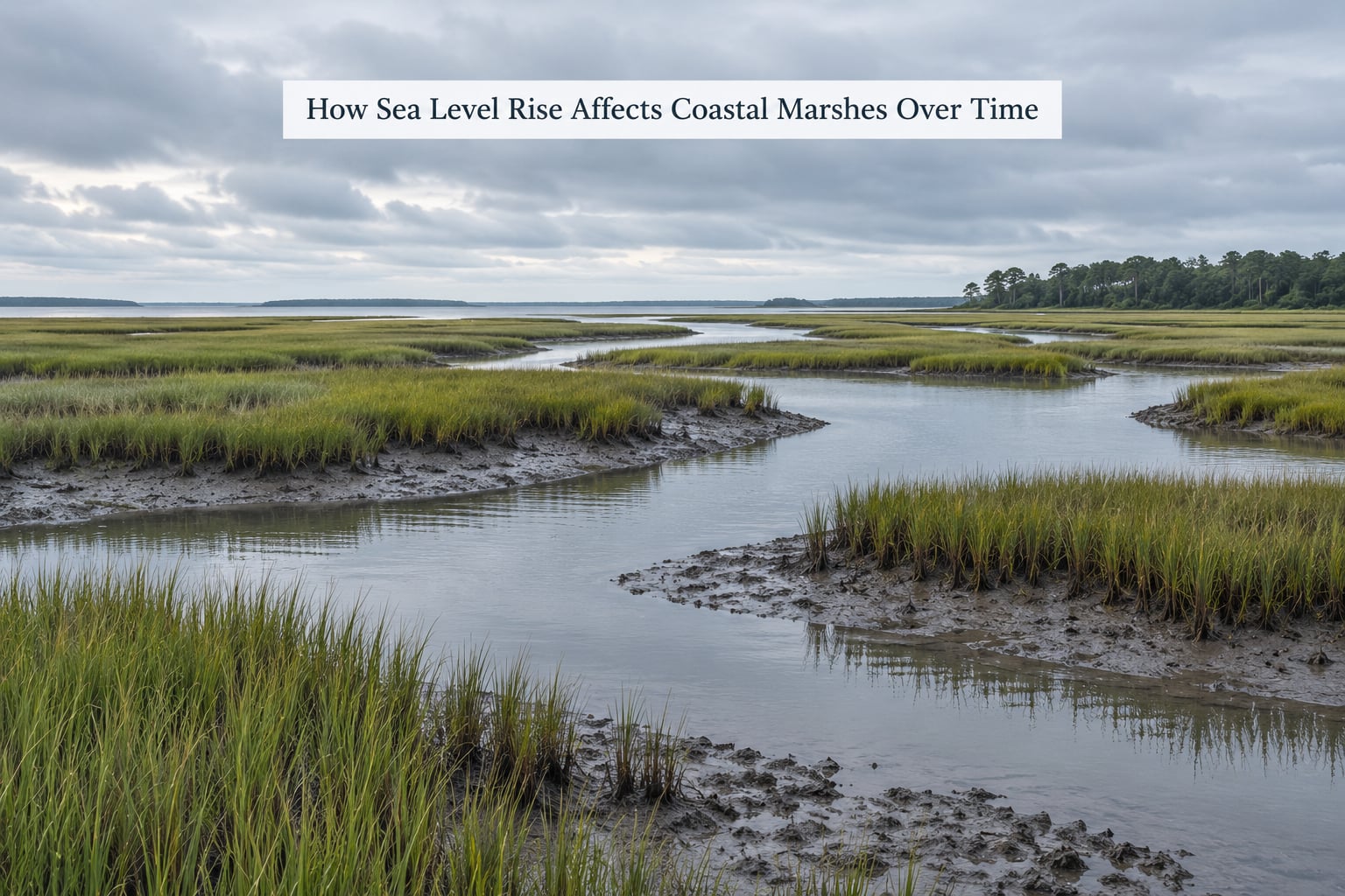
The sequence is slow and repetitive. Rising water means higher tides reach the marsh platform more days out of the year. That extra flooding triggers plant growth, which slows water, which traps more suspended sediment. Sediment and root mass accumulate at the surface, and the marsh platform rises.
This feedback is the marsh equilibrium model, developed from long-term monitoring at North Inlet, South Carolina, where researchers have collected elevation and productivity data since 1984. The model describes a narrow vertical band in which a salt marsh can persist, with an optimum elevation set by the rate of rise, the concentration of suspended sediment in the water and how productive the plants are.
Then the balance tips. If water climbs faster than the surface can build, inundation deepens and lasts longer. Cordgrass leaves go pale, roots oxygen-starve in anoxic mud and bare patches open between them. Those patches expose soil to waves, and once erosion starts, material that took decades to accumulate leaves in hours.
Given open land behind it, the marsh then transgresses landward. Upland edges flood, salt-tolerant plants take hold, and new marsh forms at a higher elevation while the old platform erodes behind it. That is migration, and in a healthy system it is how marshes have always responded to rising water.
Researchers working with Florida’s Odum Center for Wetlands have argued that at some sites, including North Inlet, sea level rise has passed the rate the marsh can accommodate, and the marsh will drown within coming decades if conditions do not change. That is a site-specific finding about an equilibrium threshold, not a universal verdict on every marsh on the coast.
Flooding, Erosion, and Habitat Shifts
More frequent tidal flooding changes who lives on the marsh before it changes the marsh itself. Species that tolerate deep saturation give way to those that need drier ground, and the plant bands you can see from a boat or boardwalk shift upslope by small increments each year.
Fish and shellfish feel it too. Juvenile striped bass, blue crab, shrimp and menhaden depend on marsh edges and creeks for nursery habitat during their first months of life. Deepen the water at the wrong time of year and those windows close. Birds follow the same logic: foraging areas for long-billed curlews, willets, clapper rails and wintering waterfowl shift as the vegetation changes.
| Change | What causes it | What you see | Ecological effect |
|---|---|---|---|
| Chronic flooding | Rising water outpaces marsh accretion | Vegetation thins, then bare mud patches spread | Nursery habitat and bird feeding areas shrink |
| Shoreline erosion | Wave and storm energy on an exposed edge | Steep raw banks of peat and roots facing open water | Decades of accumulated sediment and carbon leave the system |
| Saltwater intrusion | Tides push salt up creeks and into groundwater | Salt-tolerant plants spread into former freshwater areas | Freshwater plant communities are replaced or lost |
| Habitat conversion | Combined drowning, erosion and shoreline armoring | Marsh gives way to mudflat, then to open water | Storm surge buffering and water filtration are lost |
None of this happens on a schedule you can watch from a calendar. It shows up as a flooded trail on a familiar route, a boat launch that is soft underfoot, or a bird list that keeps turning up species you have not seen there before.
What Happens to Salt Marshes and Freshwater Marshes?
Salt marshes were built for a life of regular saltwater flooding, so a modest rise in water level is something they can absorb. Their problem is rarely salinity. It is elevation, sediment supply, and whether anything blocks them when they need to move.
Freshwater coastal wetlands have the opposite profile. They are not built for salt, so an increase in salinity from a rising tide, a deeper creek or a storm surge pushing salt upriver can change them faster than elevation change alone would. A 2022 study in Science Advances described freshwater wetlands being squeezed from the inland side by development while saltwater moved in from the seaward side.
Brackish marshes in between are the most adjustable of the three, and the ones that shift most visibly as the salt line moves. A marsh tied mainly to river discharge behaves differently again from one fed by rain and groundwater, because the fresh water arriving from inland sets the salinity balance.
Elevation still sets the ceiling. A low freshwater wetland behind a barrier island may convert to brackish marsh long before a high one changes at all. Site history matters too: a marsh that was drained for farming in the 1950s and reflooded today arrives with a different soil, a different plant community and a different response curve than one that was never touched.
Why Can Rising Seas Increase Carbon Emissions?
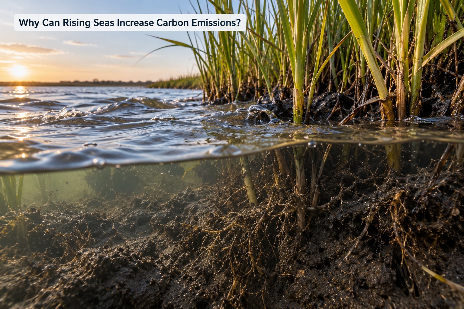
Healthy salt marshes store a lot of carbon, and the mechanism is simple. Waterlogged soil excludes oxygen, and without oxygen the microbes that break down plant material cannot operate normally. Roots, dead leaves and trapped sediment stay in an anaerobic state for decades or centuries, which is why coastal wetlands hold what is called blue carbon.
The loss side runs through the same door. When a marsh drowns, drains, burns or erodes, that stored carbon is exposed to oxygen and begins to oxidize into carbon dioxide. Peat banks eaten back by waves release what took centuries to form.
The sequence usually looks like this:
- Water rises faster than the platform builds, and the marsh shifts out of its tolerance band.
- Vegetation dies back, which removes the trapping mechanism that fed soil growth.
- Erosion exposes waterlogged peat and root mass to air.
- Oxidation releases stored carbon dioxide, and erosion also exports dissolved carbon and sediment offshore.
Estimates of how much carbon coastal wetlands release worldwide vary widely, because they depend on how much marsh is lost, how fast, and whether the eroded material is fully oxidized or buried in deeper water. Treat single headline figures with caution. The defensible statement is narrower: a living marsh is a net store, and a dying one is not.
Drainage and impoundment are the human versions of this problem. USGS research on managed coastal wetlands makes the connection directly: when wetlands are drained, impounded or restricted, it jeopardizes both their carbon processes and their existence.
How People and Development Intensify the Effects
The physics of a rising sea is slow and even. The engineering around it is not. Seawalls, levees, causeways and roads all interrupt the two mechanisms that let a marsh adapt: trapping sediment and moving inland.
A marsh behind a barrier loses its sediment supply the moment the barrier goes in, because the flood tide no longer spills mineral silt across the platform. Waves that once spread their energy over a soft marsh edge now bounce off a concrete face and concentrate scour at the base. The marsh cannot roll back the erosion, and the wall does not move.
Richardson Bay in Marin County shows the sequence clearly. Dredging and filling of its tidal wetlands in the mid-1800s severed the natural sediment supply for good. The Bothin Marsh path there now floods about 30 days a year, and projections put that near 220 days a year with one foot of sea level rise. One January storm caused damage in the Richardson Bay area that ran into the millions, and by 2050 about 2,000 buildings and 18 miles of roadway sit in the exposure zone.
Subsidence adds a second multiplier. Groundwater pumping and the compaction of organic delta sediment drop the land while the ocean rises, so the two effects add rather than offset. Pumping drainage water out of low land to keep houses dry makes the land lower still, which means bigger pumps next time.
Useful adaptation and harmful barriers can look similar on a map. The difference is whether the structure protects a place while letting a marsh function, or protects one small piece of land at the expense of the system around it.
What Conservation Strategies Can Help Coastal Marshes?
Nobody has a single fix that works everywhere, because a marsh’s options depend on its elevation, its tides, who owns the land behind it, and how much flood risk the developed area already carries. The tools that do work are mostly about giving the marsh room and sediment.
- Protect undeveloped land. The cheapest and most durable intervention is keeping migration space undeveloped. A marsh needs a buffer of upland it can move into, and that land is gone once it is subdivided.
- Restore tidal flow. Breaching berms, culverts and levees lets tides back onto drained land and rebuild the elevation feedback.
- Place sediment deliberately. Dredged material from channel maintenance can be thin-layer placed on degraded marsh surface. Matching the existing elevation gradient matters more than volume.
- Build living shorelines. Oyster reefs, marsh grass and submerged aquatic vegetation along a bayou or creek absorb wave energy where a wall would reflect it.
- Use horizontal levees and set-back structures. A levee set far inland protects more area and leaves marsh between itself and the water, which keeps sediment moving.
- Plan strategic retreat. Moving or elevating structures at the water’s edge is hard politically and expensive, but in a few places it is the only honest option.
Each has a limit worth naming. Thin-layer placement fails if the sediment chemistry is wrong for the marsh or if the receiving site is still rising too slowly. Living shorelines need water flow and enough space to grow. Restoration buys time rather than permanence, as ecologists say often enough because it is true.
What Can Outdoor Visitors Learn From Changing Marshes?
If you paddle, bird, fish or hunt on coastal marsh, you are standing in the middle of the experiment. A few things are worth watching, and most are visible without instruments.
Look at creek and channel positions first. Tidal creeks naturally migrate, and faster migration often means the platform is losing elevation. Wrack lines, the mats of dried grass and shell left at the high-water mark, also shift upslope over time.
Mudflat expansion is another one. Where grass gives way to open mud, and mud gives way to water, that transition is the drowning sequence in plain view. Vegetation bands move upslope, and the boundary between high marsh and upland edge gets closer every season.
Access changes are the part that reaches people directly. Trails flood more often, boardwalks need rebuilding after storms, and launch ramps turn to mud before they flood. Boat channels that were reliably deep last season may shoal, because sediment is redistributing as the marsh edge erodes.
On public land, stay off the marsh surface where vegetation is recovering. Cordgrass root mats are the structural layer holding soil in place, and walking them opens bare patches that waves exploit later. Keep distance from roosting and nesting birds, and follow closure signs rather than judging the water yourself, because a flooded trail is sometimes a flooded bird roost.
Citizen monitoring programs run by state agencies, universities and conservation groups welcome survey data on marsh elevation and vegetation. Elevations are usually measured with the standard foraminifera surface-elevation method, so trained volunteers are the ones turning readings into numbers. Showing up for those surveys or reporting trail damage to land managers is more useful than almost anything else a visitor can do.
Frequently Asked Questions
Will all coastal marshes disappear as sea level rises?
No. Marshes survive by building elevation from trapped sediment and organic matter, and in open settings they often shift inland as the shoreline retreats. Loss happens fastest where sediment supply has been cut off or development blocks migration, which is why protected migration corridors matter so much.
Why can a coastal marsh not simply move inland?
Because the land behind it is usually already spoken for. Roads, seawalls, housing subdivisions and farmland occupy the upland edge a marsh would need to flood and convert. That trapped condition is called coastal squeeze, and it turns a migrating system into a shrinking one.
Do seawalls protect marshes from sea level rise?
They protect the property behind them, but not the marsh. Walls block the sediment supply, reflect wave energy into the marsh edge and fix a shoreline that a living marsh would keep moving. Levees set farther inland, living shorelines and restored tidal flow work better for the system.
How long does it take for sea level rise to change a marsh?
Decades, usually. Marsh loss is rarely a single dramatic event; it shows up as thinning vegetation, rising bare patches and edge erosion that accumulate over years to decades. Long-term monitoring sites such as North Inlet in South Carolina have been measuring this change continuously since 1984.
What can I do to support coastal marsh conservation?
Support protecting undeveloped land near marshes, which is the single cheapest way to keep migration space open. Join a volunteer marsh monitoring or elevation survey, report flooded trails and damaged boardwalks to land managers, and favor living shorelines and set-back structures in local shoreline plans.
Conclusion
Sea level rise affects coastal marshes through a handful of interacting pressures rather than one cause: rising water, ground that may also be sinking, sediment supplies that levees and dredging have cut off, and development that closes off the inland direction a marsh needs. Read those together and the picture is clearer than any of them alone.
The first thing worth doing is local. Find out whether your marsh has elevation data, whether its sediment supply is intact and whether anything physical blocks it from moving inland, because that answers most of what you were wondering. Then support the measure that protects migration space and restores tidal flow, whichever one that turns out to be for the marsh you care about. That is where the tide is going regardless.
Last reviewed: October 2026. Sources include NOAA, USGS, the IPCC, the University of Florida Odum Center for Wetlands and the North Inlet-Winyah Bay Reserve for Coastal Research.