To tell a freshwater marsh from a salt marsh, look at two things first: whether smooth cordgrass (Spartina) grows there, and whether tides flood it on a schedule. If the grass is cordgrass and the water comes in twice a day, it is a salt marsh. If you are standing in cattails and bulrush beside a creek that floods after a hard rain, it is freshwater.
That is the short version. The longer answer is that salinity selects the plant community, and the plants are what you can actually see, so you can read a marsh without a lab kit. Most people get confused because the categories blur at the edges: plenty of marshes are brackish, and some freshwater marshes flood twice a day anyway.
I have walked both kinds for years, and the mistakes I see repeat are the same every time. Someone decides a marsh is freshwater because it has green grass, or decides it is salt because it is near the coast. Both calls can be wrong. Below is the field procedure I use, in the order that settles a site fastest.
Definitions and thresholds below follow the standard wetland classification work used by the US Fish and Wildlife Service, NOAA and NatureServe, and were last checked for accuracy in 2026.
Table of Contents
- How to Tell a Freshwater Marsh From a Salt Marsh at a Glance
- Check the Water Salinity First
- What makes a salt marsh a salt marsh
- Look at the Dominant Plants
- Examine the Soil and Mud
- Identify Tides and Water Movement
- Use Wildlife as Supporting Clues
- Which Type of Marsh Fits Your Location?
- Frequently Asked Questions
- What is the easiest way to tell a freshwater marsh from a salt marsh?
- Can salt marshes contain freshwater plants?
- Do freshwater marshes have tides?
- What salinity range usually defines a salt marsh?
- Are marsh plants reliable for identifying saltwater?
- What is a brackish or transitional marsh?
How to Tell a Freshwater Marsh From a Salt Marsh at a Glance
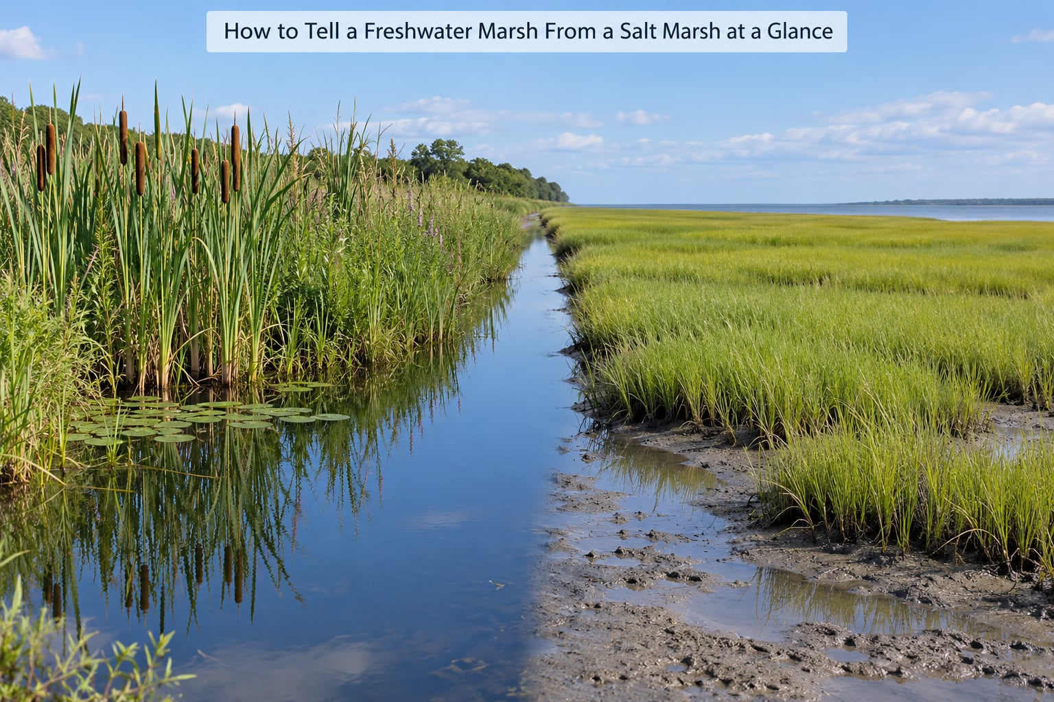
Five clues do most of the work: salinity, flooding pattern, dominant plants, soil, and the animals using it. The table below puts the two marsh types next to each other so you can match what you are looking at.
| Clue | Freshwater marsh | Salt marsh |
|---|---|---|
| Salinity | Under 0.5 parts per thousand | 18 to 35 parts per thousand, often brackish in between |
| Flooding | Rain, snowmelt, stream flow or groundwater; may be seasonal | Tides, usually at least twice a day |
| Dominant plants | Cattail, bulrush, pickerelweed, soft rush, sedges | Smooth cordgrass, saltmeadow hay, black rush, glasswort |
| Soil | Dark peat or muck, often acidic | Gray, brown or tan mud, often with sand and shell fragments |
| Smell | Green, swampy, sometimes sulfurous | Briny, especially on the mud at low tide |
| Typical birds | Least bittern, swamp sparrow, rails, wood ducks | Clapper rail, sharp-tailed sparrow, willets, sandpipers |
| Typical animals | Beaver, muskrat, turtles, frogs | Fiddler and ghost crabs, mud snails, Atlantic croaker |
One row deserves a flag: the salinity bands overlap in the middle, and the middle is real. Read the plant and flooding rows together with the salinity row, not on their own.
Check the Water Salinity First
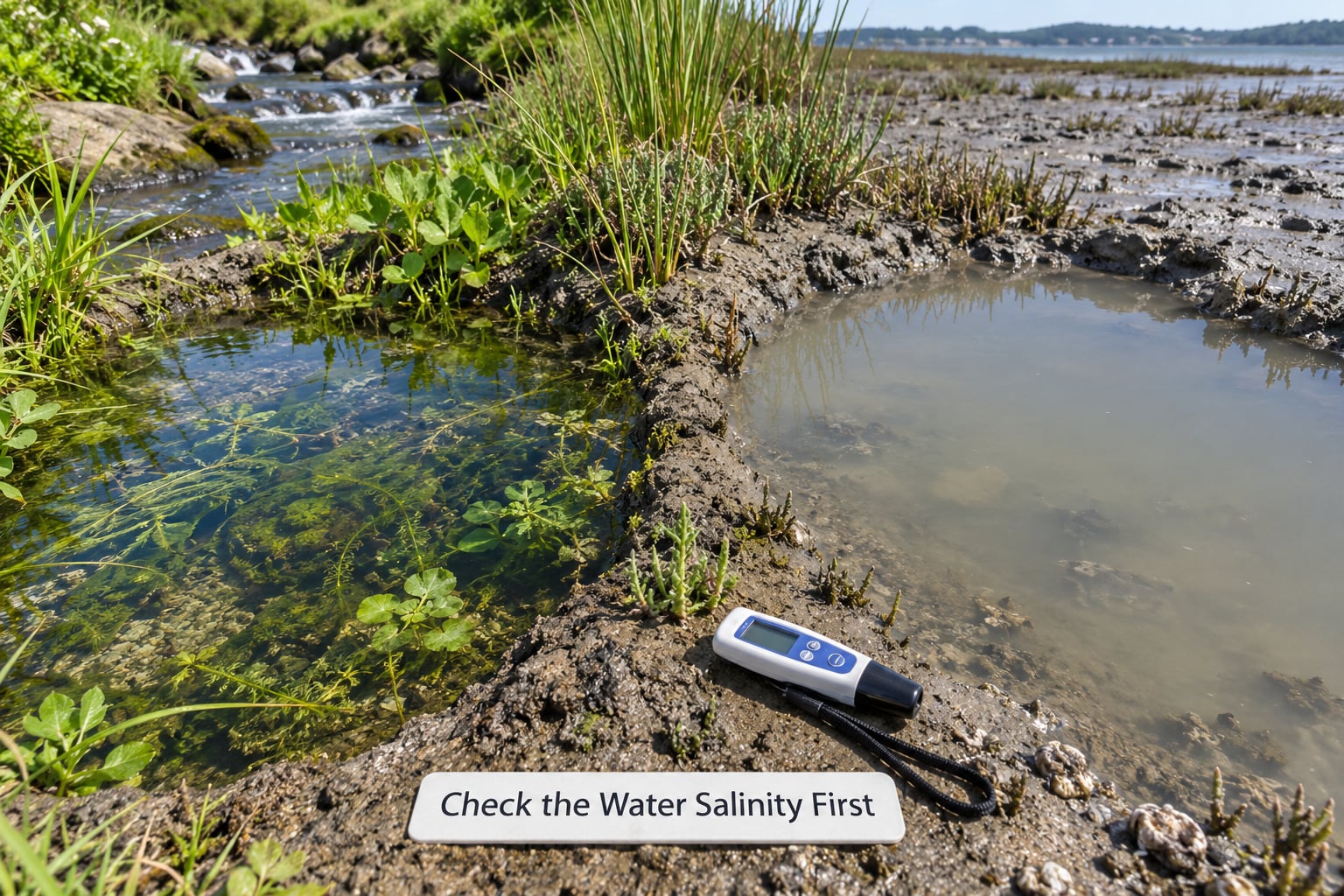
Salinity is the defining variable, so it is the most honest test. Freshwater marshes hold water with essentially no dissolved salt, generally under 0.5 parts per thousand (ppt). Brackish marshes fall between roughly 0.5 and 18 ppt. Salt marshes run from about 18 ppt up toward seawater at 35 ppt, though most of the time you will measure lower because river water dilutes the tide.
Three cheap ways to check in the field:
- Refractometer. A handheld saltwater refractometer reads in ppt directly and is accurate enough to place a site in a band. This is the tool wetland delineators use.
- Hydrometer. A floating hydrometer works in a jar of water. Less precise, but fine for separating clearly fresh from clearly salty.
- Evaporation cup test. Fill a small cup with marsh water, set it in the sun, and see what is left behind. Clean water leaves a faint mineral ring. Brackish water leaves a visible salt crust, sometimes within a day. It is rough science, but it settles arguments in a hurry.
Taste works on a marsh pool but do not do it often. Do not put your face in the water. Salt marshes also carry vibrio bacteria, and the soft mud hides drop-offs and holes that swallow waders.
Timing matters as much as the reading. Sample on a low tide and at high tide, because a site near a creek mouth can swing widely within a day. And check twice across the year, since rainfall and drought shift the numbers more than most people expect.
What makes a salt marsh a salt marsh
Regular flooding by seawater plus salt-tolerant vegetation. Take away either piece and the classification changes: a marsh flooded only by rain is freshwater, and a salt marsh with no cordgrass has usually been altered by ditching, impoundment or invasion.
Look at the Dominant Plants
Plants are the most reliable field clue, because only the ones built for salt can survive in salty mud. Salt-tolerant plants are called halophytes, and many of them push salt out through their leaves, which means you can sometimes see the crystals on the underside of a leaf with a hand lens.
Freshwater marsh indicators:
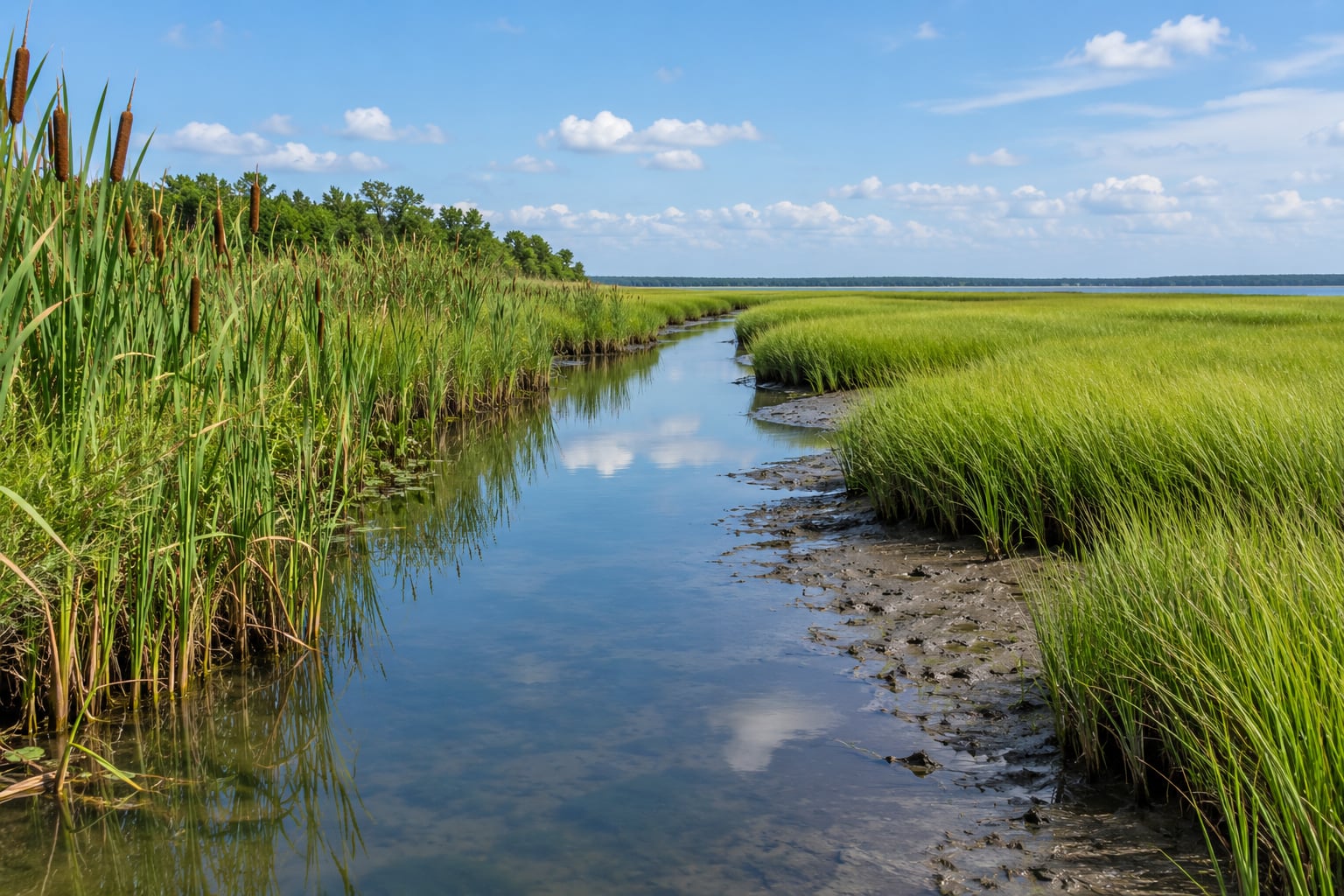
- Cattail (Typha) with its brown sausage-shaped seed head.
- Hardstem bulrush and softstem bulrush, the round sedge-family plants that dominate northern marsh.
- Pickerelweed (Pontederia cordata), with broad heart-shaped leaves on stiff stems.
- Soft rush and tussock-forming sedge.
- Sugarberry, buttonbush and alder along the wet edge.
Salt marsh indicators:
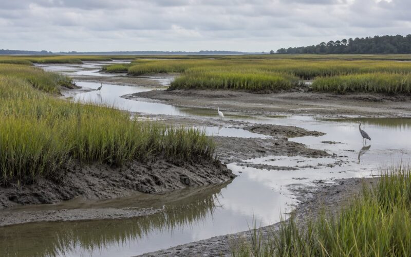
- Smooth cordgrass (Spartina alterniflora), the tall grass that fills the lowest parts of an Atlantic and Gulf salt marsh and stands in a band roughly waist to shoulder high.
- Saltmeadow hay (Sporobolus pumilus) and saltgrass, covering the drier high marsh.
- Black rush (Juncus roemerianus) in southern marshes, forming tall dark stands.
- Glasswort (Salicornia), also called pickleweed, the low succulent that turns red in late summer.
- Sea lavender and spike rush in the mix.
Regional names shift, so match by form rather than label. On the West Coast and the Great Basin the dominant plants are pickleweed and saltgrass rather than cordgrass, and Pacific saltmarsh looks nothing like an Atlantic bay. The rule holds anyway: if you see plants that thrive in salt, you are looking at salt water.
Examine the Soil and Mud
Pull a handful of mud and look at it. Freshwater marsh soils are usually dark brown to nearly black, high in organic matter, and built from peat or muck that formed in place as roots died and the waterlogged soil starved of oxygen. It smears, smells swampy, and often releases sulfur when you squeeze it.
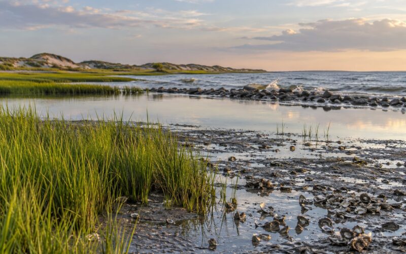
Salt marsh mud tends to be gray, tan or olive-brown with a lot of mineral sediment delivered by tides. Shell fragments, sand and tiny crabs tell you the mud came in from an estuary rather than accumulating on site. On a hot day at low tide, a faint white crust on the surface means salt is concentrating where the water left.
Soil alone is not a verdict. Tidal freshwater marshes can carry freshwater mussels and shell hash, and freshwater marshes in salty regions can look deceptively saline after a drought year. Use soil as corroboration, not as the deciding clue.
Identify Tides and Water Movement
Tides are the giveaway. Salt marshes connect to an estuary through branching tidal creeks and flood on a predictable cycle, most days at least twice. Watch the water for fifteen minutes at a spot where you can see a marker, or check the tide tables for your area and time a visit around the peak.
Freshwater marshes are fed by rain, snowmelt, streams, seeps or groundwater. The flooding is tied to weather instead of a clock, so it may be there all summer or gone for weeks. Some freshwater marshes are dry for part of the year and hold a few inches of water in spring.
Here is the case that breaks the simple rule: a tidal freshwater marsh gets flooded by tides and holds genuinely fresh water, usually because a river dilutes the incoming seawater. Around 9 percent of tidal marshes in the United States fit this description. If you concluded that tides mean salt water, this is the trap that makes people distrust the whole classification. The plants tell you the truth here: cattails and pickerelweed in a tidal site means fresh.
Inland salt marshes exist too, which is the mirror-image exception. Saline springs feed marshes in places like the Great Basin and the San Francisco Bay region, far from open ocean. So “salt marsh” means salt water, not “near the beach.”
Use Wildlife as Supporting Clues
Animals confirm a call but rarely make it on their own. If you are wading a marsh and the mud pops with fiddler crabs waving claws, or you flush a flock of willets and sandpipers from a short-grass flat, you are in the salt marsh category. If a least bittern slips out of dense cattail at your feet, or a swamp sparrow pops up from a sedge hummock, you are in freshwater habitat.
Salt marsh specialists are genuinely narrow in range: clapper rails, saltmarsh harvest mice, seaside sparrow, black rail in southern wetlands. Birds cross the boundary constantly, which is exactly why plant and water evidence has to lead.
For hunters, the same distinction sets expectations. Ducks stage on brackish and saltwater edges early in the season, then move to freshwater marshes as the season deepens and the salinity drops.
Which Type of Marsh Fits Your Location?
Work outward from the setting. A marsh at the outlet of a lake, beside a spring-fed stream or in a river bottomland is almost always freshwater. A marsh reached by daily tides through a creek, bay or sound is brackish to saline. A marsh fed by a saline spring in an arid basin is salt despite being nowhere near the coast.
If you can only check one thing, check the plants and the flooding together. Cordgrass plus a daily cycle means salt marsh. Cattail, bulrush or pickerelweed means fresh, even if it floods twice a day. Anything in between is a brackish marsh, and the honest answer is that the site sits in the middle of the gradient rather than in one camp.
Before you record or publish an observation, cross-check what you saw against a recent aerial photo and the plant list on a regional wetland database. Two visits in different seasons will settle nearly anything you find ambiguous in one.
Frequently Asked Questions
What is the easiest way to tell a freshwater marsh from a salt marsh?
Look for smooth cordgrass and check whether tides flood the site. Cordgrass plus a twice-daily flooding cycle means salt marsh. Cattails, bulrush or pickerelweed mean freshwater, even at a tidal site. If you can test the water, under 0.5 ppt is freshwater and 18 to 35 ppt is salt marsh.
Can salt marshes contain freshwater plants?
Not where regular saltwater flooding reaches them. Salt selects the plant community, so freshwater species like cattail and pickerelweed cannot persist there. The exception is the tidal freshwater marsh, where a strong river dilutes the tide and freshwater plants grow on a tidal schedule. That site is classified by its salinity, not its tide.
Do freshwater marshes have tides?
Some do. A tidal freshwater marsh floods twice a day with water that has been diluted to fresh by river flow, and about 9 percent of tidal marshes in the United States are in this category. Inland freshwater marshes flooded by rain or streams have no tide at all, so a predictable tide alone does not make a marsh salty.
What salinity range usually defines a salt marsh?
About 18 to 35 parts per thousand, with most measurements lower because river water dilutes the tide. Freshwater marshes sit below 0.5 ppt and brackish marshes fall between roughly 0.5 and 18 ppt. A handheld saltwater refractometer or a hydrometer in a sample jar will place a site in the right band.
Are marsh plants reliable for identifying saltwater?
Yes, they are usually the most reliable field clue available. Halophytes such as smooth cordgrass, saltmeadow hay, black rush and glasswort can only grow in salty conditions, and their dominance is the standard basis for mapping marsh types. Regional differences exist, so match plant form to your coast rather than relying on a single species name.
What is a brackish or transitional marsh?
A marsh with mixed fresh and salt water, usually where a river meets a tidal estuary. Salinity falls in the broad middle range of roughly 0.5 to 18 ppt and shifts with tide, season and rainfall. Brackish marshes hold plant communities that overlap both ends, including pickerelweed on the fresh side and saltmeadow hay on the salty side.
Start with the plants, then confirm with the water. Cordgrass in a site that floods on a tide is a salt marsh, and cattails and bulrush in a creek-bottom marsh are a freshwater marsh. If the two signals disagree, sample the water and come back in a second season before you write it down.